At a glance
- Whitehaven Beach is approximately 35 km from Airlie Beach by sea, out among the Whitsunday islands.[1]
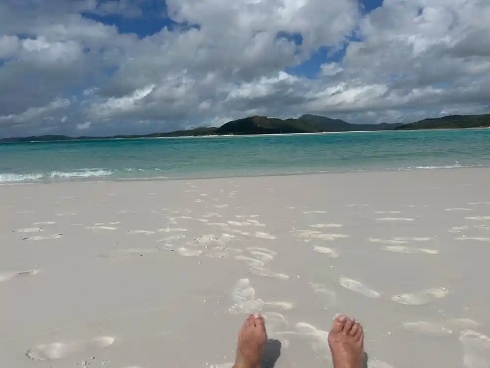
- Whitehaven Beach is a little over four miles long, and its sand is composed of 98 percent silica.[2]
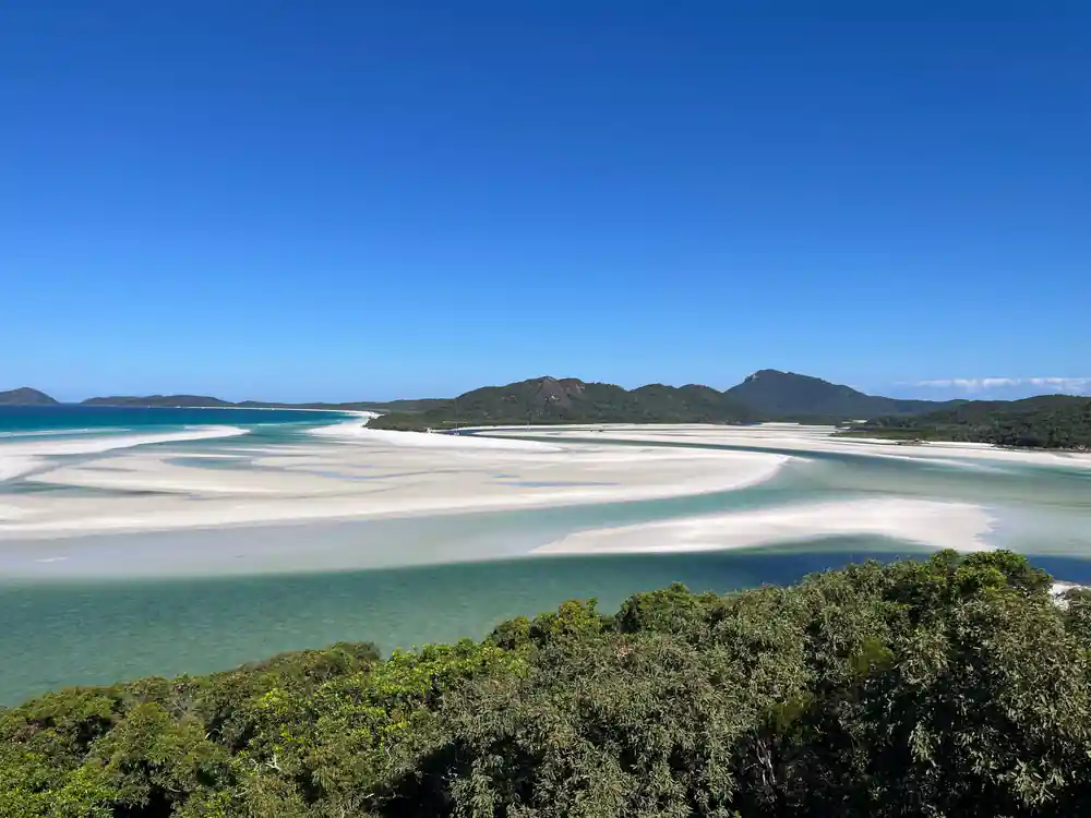
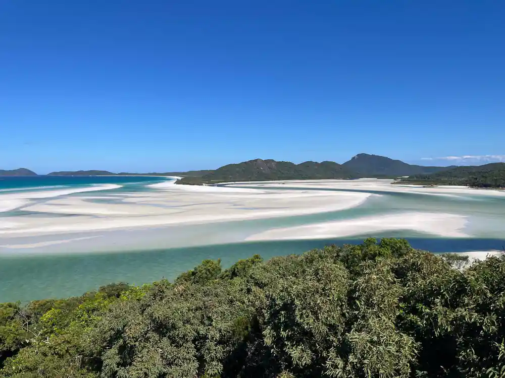
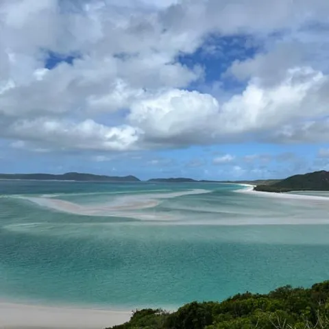
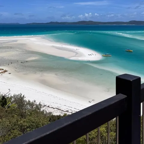
- At Hill Inlet Lookout, swirling sands and turquoise waters change with the tides.[3]
- The Ngaro were a seafaring tribe who inhabited the Whitsundays Islands and coastal areas nearby.[4]
- The dry season from June to October is the best time to visit, and September is named the best month.[5]
- Top choice Eco-Cruise with Buffet from US$175 Duration8 hours[6]Traveller rating4.78 from 3,065 reviews[6]Value for money4.6[6]CancellationFree cancellation up to 24 hours[6]StopsHill Inlet, Whitehaven, Hook Island Check availability
- Snorkel & Hill Inlet from US$174 Duration6.5 hours[7]Traveller rating4.84 from 2,331 reviews[7]Value for money4.7[7]CancellationFree cancellation up to 24 hours[7]StopsSnorkel, Hill Inlet, Whitehaven See this tour
- Camira Sailing Day from US$182 Duration10 hours[8]Traveller rating4.70 from 1,423 reviews[8]Value for money4.6[8]CancellationFree cancellation up to 2 days[8]StopsWhitehaven Beach, Hill Inlet See this tour
The Ngaro were a seafaring tribe that inhabited the Whitsundays Islands and coastal areas stretching from Cape Conway and down as far as the mountains to the east of Proserpine.
Sail a drowned mountain range
Check before booking
On the day
- Most tours provide protective suits to swim safely in stinger season.[1]
- The eco-cruise runs 8 hours; check availability to see starting times.[6]
- Take a hat, sunglasses and plenty of water; shade is scarce on the beach.
- Marine Park visitors pay the environmental management charge to the permit holder.[9]
Drowned Mountains: How the Whitsunday Islands Began
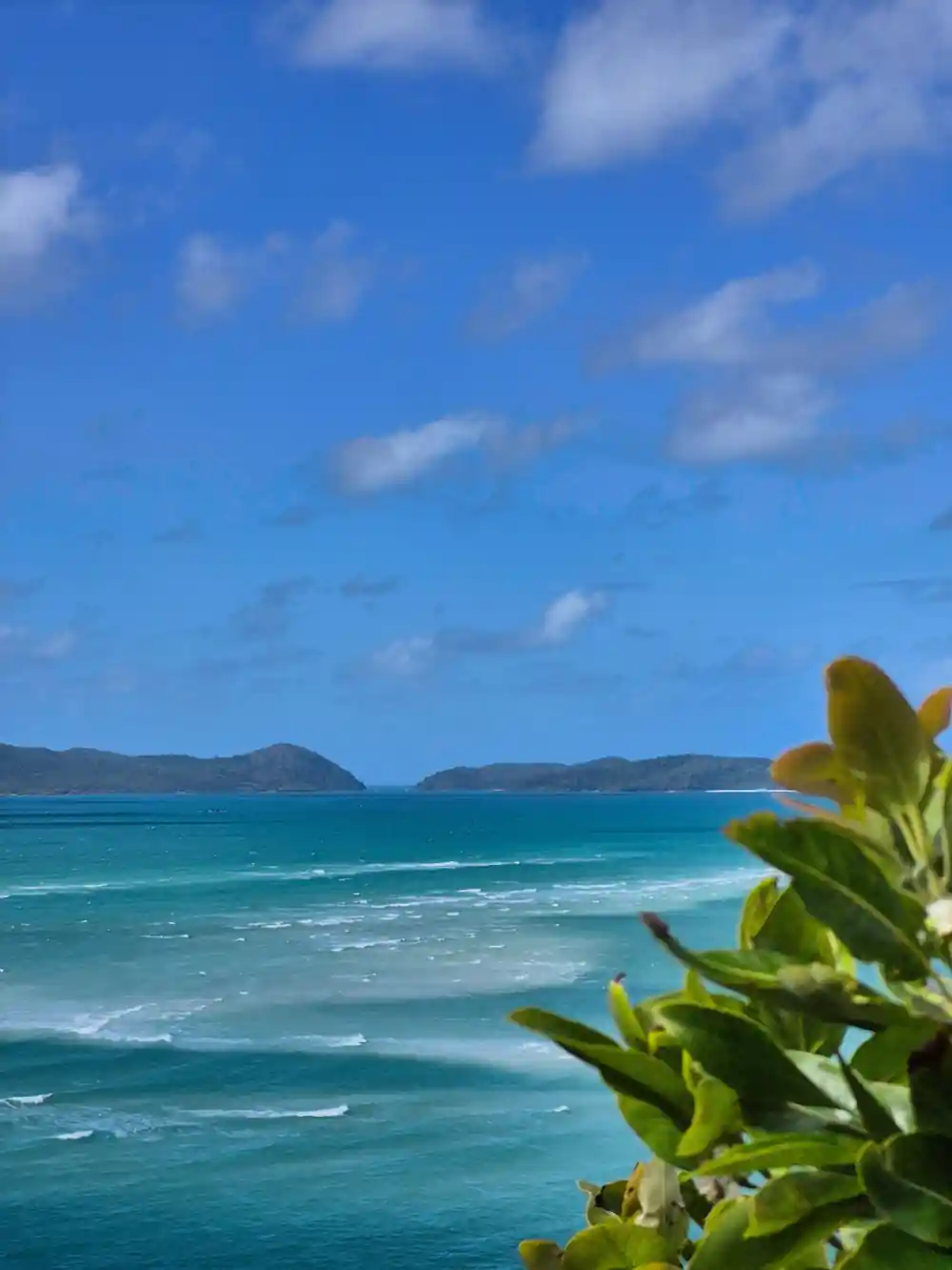
From a lookout above Airlie Beach, the Whitsundays look like a scattering of green humps dropped onto a blue plain. They were hills once. With the sea far lower, these were ridges and valleys on a coastal plain, with creeks between them and forest on the slopes. As the ice melted, the ocean walked up the valleys, over the saddles and into the low ground, and the higher country became islands.
The channels between the islands are deep, and many anchorages sit in what were once riverbeds. The rock underneath is mostly granite: coarse, pale and jointed, weathering into rounded boulders and steep little gullies. Granite is also the beginning of the famous sand. Quartz from these slopes has been washed, tumbled and sorted by tide and current until it ends up pale, fine and slow to hold heat underfoot.
The tide does much of the rest of the shaping. Water floods and drains through the gaps in the group, lifting sand in the channels, sweeping the shallows clean and rearranging the inlet mouth. From the deck of a boat the islands look permanent, and they are also being rebuilt all the time, just slowly enough that nobody notices.
The Ngaro and the Idea of Sea Country
The Ngaro were a seafaring tribe that inhabited the Whitsundays Islands and coastal areas stretching from Cape Conway and down as far as the mountains to the east of Proserpine.[4] Read that as a marine chart in words: a coast, a strait and an island group, all named together as one territory. It is worth saying out loud on a boat: this is a lived-in seascape with a very long history of use, not empty water.
Sea country is the framing that makes that territory make sense. The water is not empty space between places, it is the place: reefs, seagrass, channels and the tidal cycle that links them. Bays gave shelter, headlands gave lookouts, and shallow reef gave a dependable larder.
That knowledge did not vanish with the canoes. The practical read of this coast is much the same one a skipper uses today: wind direction, tide state, and which side of an island will be calm in the afternoon. Visitors sail through country that was mapped by use long before it was mapped on paper.
Shallow turquoise water over pale silica sand, with islands stacked to the horizon.
Whitsunday or Whitsundays? Where the Names Come From
Is it Whitsunday or Whitsundays? Both are correct, and the difference is only number. Whitsunday is the singular, attached to the passage between the islands, to the island that holds Whitehaven Beach, and to the festival in the Christian calendar that the passage was named for. Whitsundays is the plural, and it takes in the whole island group and the water around it.
In everyday use, the plural does most of the work. Airlie Beach sits on the mainland, not on an island, so people stretch the name to cover the whole picture: the town, the marina, the islands offshore and the reef beyond. Plan a trip with Airlie Beach Whitsundays in mind as a single idea and you will not go far wrong.
The Whitehaven Beach name belongs to the same habit of naming new coastlines after old ones. Whitehaven is a port town on the Cumbrian coast of England, and it arrived here on a chart. Names like that are a reminder that this coast has been named more than once, by people who came with very different ways of knowing it.
Why Hook Island Went Quiet
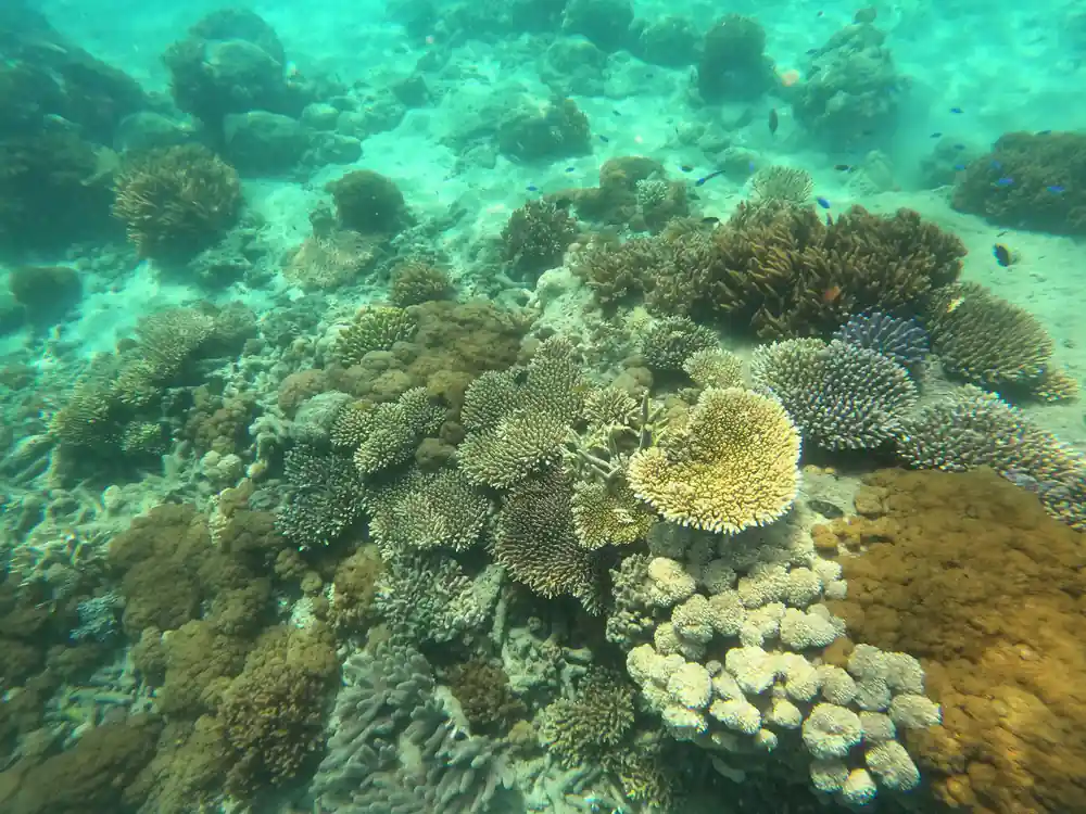
Across the top of Hook Island there is a series of bays that all offer excellent quality snorkelling with beautiful healthy coral and diverse marine life.[10] Bays are good at that: they hold calm water, offer easy entry, and give fish somewhere to gather out of the current.
Hook Island also carries traces of a busier past. Islands are hard places to run anything: fresh water is scarce, power has to be made on site, everything else arrives by boat, and the weather is never fully on side. Whatever once stood on these shores has largely been taken back by the forest.
What remains is quiet island country, with anchorages that fill and empty with the day boats. If you want reef without a crowd, the bays along the top of the island are worth asking about when you book, and worth asking for by name. Ask what the tide will be doing when you arrive, because slack water is the friendly option for a first snorkel.
from US$175
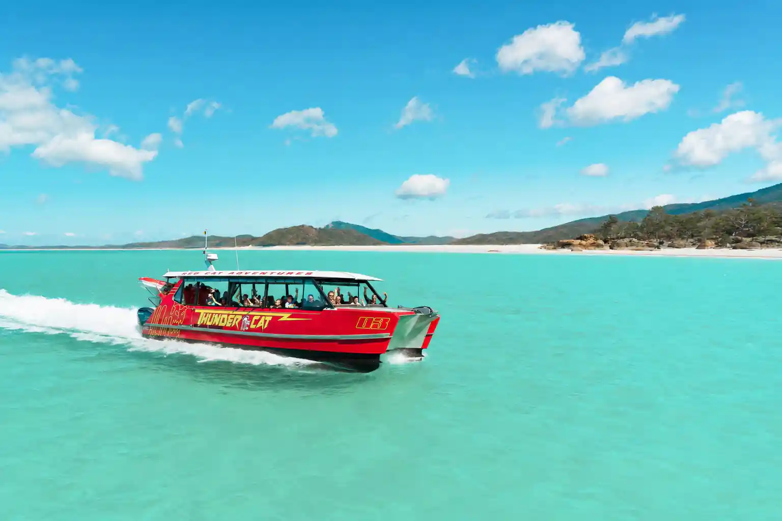
The full-day eco-cruise from Airlie Beach takes in Hill Inlet, Whitehaven Beach and Hook Island, rated 4.78 from 3,065 reviews.[6]
Hill Inlet Lookout and Whitehaven Beach
Hill Inlet Lookout is worth the climb. From the platform, swirling sands and turquoise waters form a mesmerising natural phenomenon that changes with the tides.[3] Come at a different tide state and you get a different picture: sandbars reaching out, channels cut across them, the whole inlet redrawn.
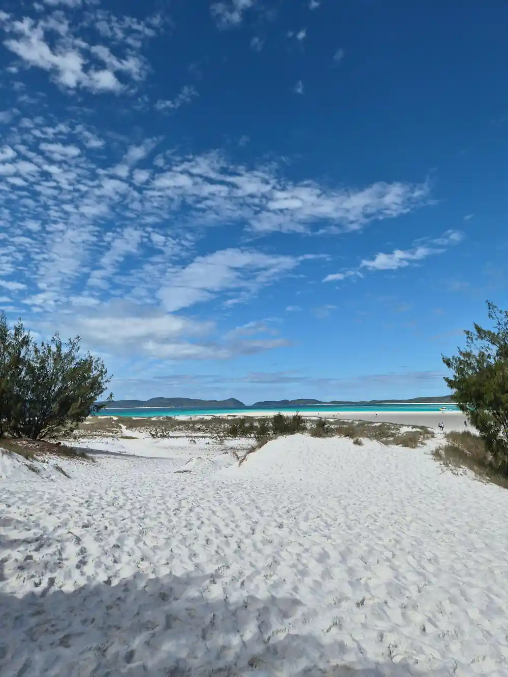
Whitehaven Beach is a little over four miles long, and its sand is composed of 98 percent silica.[2] Quartz sand behaves differently from shell or coral sand. It is very pale, it squeaks underfoot, and it stays cooler than darker sand, which makes a long walk along the waterline comfortable even in the middle of the day.
The beach sits approximately 35 km from Airlie Beach by sea.[1] Bring everything with you. The only facilities you will find at Whitehaven Beach are public toilets up at Hill Inlet Lookout and public toilets and picnic tables at the campgrounds near South Whitehaven Beach.[11] If you would rather stay overnight, there is a camping area behind the beach in Whitsunday Islands National Park, suitable for walk-in camping with a hybrid toilet and picnic tables.[12]
Snorkelling and Marine Life of the Whitsundays
The Whitsundays has six species of whale and four species of dolphin officially recorded as calling the area home.[13] Sightings are never guaranteed. Whales move through on their own schedule, and dolphins tend to appear when nobody is looking, so keep an eye on the horizon during any crossing.
At Whitehaven Beach the water is usually calm, warm and clear, and during stinger season (November to April) most tours provide protective suits to swim safely.[1] Take the suit even when the water looks perfect. It is a thin layer, it keeps you in the water longer, and it is simply part of how a day on this coast works.
Reef snorkelling is a different texture of day: shallow coral gardens, parrotfish and wrasse working through the branches, the occasional turtle cruising off the edge. Hook Island's bays are the classic stop for it, with coral close enough to the surface to spot from the boat, and clear water on a slack tide.
Management Today: National Park and Conservation
For most tourism operations, Marine Park visitors participating in a tourist activity are liable to pay the environmental management charge to the permit holder, who then remits the charge to the Reef Authority.[9] The idea is simple: the people who use the Marine Park help pay for looking after it.
The camping area behind Whitehaven Beach sits inside Whitsunday Islands National Park.[12] That shapes a visit more than you might notice. There are no bins, no kiosks and no shortcuts, and whatever you carry in comes back out with you, including fruit peel that people assume is harmless.
For visitors, most of it comes down to manners. Do not stand on coral, keep a respectful distance from turtles and rays, take photographs rather than shells, and wear a reef-safe sunscreen if you are getting in the water. Choose an operator who briefs people properly and you will do less harm and see more.
How long Whitsundays day tours run
Durations as listed for these Airlie Beach tours.[6][7][8][14][15]
Day tour from-prices in US dollars
All amounts are US dollar from-prices of the GetYourGuide listings.[6][7][8][15]
When to go
How to plan the day
Book the boat
The eco-cruise runs 8 hours and starting times vary, so check availability when you book.[6]
Sort the transfer
Pickup runs from 24 pickup location options around Airlie Beach, so confirm yours in advance.[6]
Pack light
Pack everything you need. The only facilities at Whitehaven Beach are public toilets at Hill Inlet Lookout and the campgrounds.[11]
Watch the season
The dry season from June to October is the best time to visit, and September is named the best month.[5]
Climb and swim
Hill Inlet Lookout is worth the walk: swirling sands and turquoise water change with the tides.[3]
Book the Whitehaven full-day eco-cruise
from US$176Reserve now & pay later